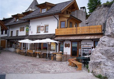
HOW TO GET THERE: from Camporosso via the Monte Lussari cable cars (for timetable information, call the Tarvisio Infopoint on +39 0428 2135) that takes 15 minutes. From Valbruna: Take the road that leads to the Val Saisera, until you reach the start of the CAI 615 trail and then continue on the CAI 616 and forest road (2 hours). From Camporosso: Along the CAI 613 “del Pellegrino” trail (approximately a 2 hours’ walk). The mountain hut is part of a small group of buildings located around the Sanctuary of Mariano Lussari. Services Luggage transportation, guided hikes.
HOW TO GET THERE: from Camporosso: Via the Monte Lussari cable cars (for timetable information, call the Tarvisio Infopoint on +39 0428 2135) that takes 15 minutes. From Valbruna: Take the road that leads to the Val Saisera, until you reach the start of the CAI 615 trail and then continue on the CAI 616 and forest road (2 hours). From Camporosso: Along the CAI 613 “del Pellegrino” trail (approximately a 2 hours’ walk). The mountain hut is part of a small group of buildings located around the Sanctuary of Mariano Lussari. Luggage transportation, guided hikes.
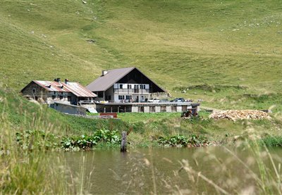
The malga was recently restructured, while retaining its original architectonic characteristics. Nearby, you can visit Lake Malins and observe the many newts that inhabit its waters. This picturesque Alpine landscape is particularly suggestive, due to a gorgeous view of the Pesarine Dolomites. By proceeding left from the shelter, you can reach malga Vinadia Grande and then descend towards the Pesarine Valley.
The pasturing area - which consists of various environments, the grazing space, the buildings, the wood and the waterholes - is frequented by numerous bird species, such as black redstarts and yellowhammers that find ideal feeding and nesting conditions in this area. However, the large amount of small birds also attracts their most deadly predator, the Eurasian sparrowhawk. By proceeding beyond the shelter, you will reach malga Pieltinis and the homonymous mountain (CAI trail n. 206).
CAI trail n. 402, which connects Pramosio to Malpasso, features the memorial plaque dedicated to Maria Plozner Mentil, killed while carrying supplies to the frontline. Her story and that of all Carnic Bearers was progressively forgotten up until 1997, when the former President of the Italian Republic Scalfaro awarded these historical figures with the Gold Medal for Military Valour. From the Pramosio Pass you can visit numerous First World War sites and structures such as tunnels, trenches and posts. Malga Pramosio is the location of the only medieval mining tunnel in the eastern Alps, still intact in its original state. By proceeding beyond the shelter on CAI trail n. 402, you can reach the Malpasso ricovero Morgante shelter, the shelter of the Manze and, at an even higher altitude, the Upper Pramosio shelter with the splendid Lake Avostanis, surmounted by one of the most beautiful cliffs in the eastern Alpine range.
The pastures of malga Pieltinis cover the entire East flank of the homonymous mountain and the valley line beneath the peak features one of the richest heath areas in the whole Carnic Alps range. In addition to Alpine rhubarb, the meadows next to the malga also feature Alpine Timothy-grass, dandelions and specimens of Campanula scheuchzeri. From the Pieltinis shelter visitors can climb rightwards, traverse the Ielma pass and descend towards the Ielma di Sopra and Ielma di Sotto malghe before reaching the Pesarine Valley (CAI trail nThe pastures of malga Pieltinis cover the entire East flank of the homonymous mountain and the valley line beneath the peak features one of the richest heath areas in the whole Carnic Alps range. In addition to Alpine rhubarb, the meadows next to the malga also feature Alpine Timothy-grass, dandelions and specimens of Campanula scheuchzeri. From the Pieltinis shelter visitors can climb rightwards, traverse the Ielma pass and descend towards the Ielma di Sopra and Ielma di Sotto malghe before reaching the Pesarine Valley (CAI trail n. 218); turn leftwards from the lodges to traverse the Pieltinis pass and descend towards the Vinadia Grande malghe (CAI trail n. 204).. 218); turn leftwards from the lodges to traverse the Pieltinis pass and descend towards the Vinadia Grande malghe (CAI trail n. 204).
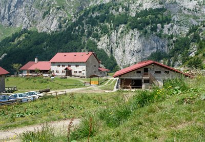
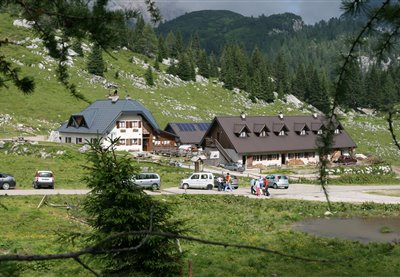
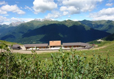
The Montasio plateau, a place of extraordinary beauty, is the largest grazing area in the entire region. The following malghe are all located in this district: Cregnedul di sopra, Larice, Parte di Mezzo and Pecol, dedicated to cheese production and agro-tourism. The history of the area describes the birth of Montasio cheese at the start of the thirteenth century, thanks to the Benedictine monks from Moggio Udinese. From a naturalistic point of view, in this area visitors can encounter rooster combs, broom flowers, marmots, deer, chamois, roe deer and foxes. From the Plains of the Montasio, you can return to Sella Nevea and descend towards Tarvisio via the town of Cave del Predil with its charming lake. Starting from the Pecol shelter, you can also easily reach the Giacomo Di Brazzà Refuge (on CAI trail n. 622), a splendid balcony looking onto the Mount Canin range.
In 1478, on Plan di Lanze, a violent battle took place between the Turks – who were trying to cross the pass – and Venetian troops flanked by Carnic militias. The Turks were defeated and pushed back, and the Carnia area was therefore saved from their dreaded raids. According to legend the name, Plan di Lanze, derives from the lances abandoned on the battlefield by the defeated Turks. A didactic rocky gym has been built at a distance of just approximately one hundred metres from the shelter. This site offers a magnificent view of Mount Zermula and of the Creta di Aip. The shelter is the ideal starting point for many excursions, including climbs towards Mount Zermula (2.143 m) (CAI trails n. 442 and 442A), or towards the Lomasti bivouac, via malga Val Dolce and the Aip Valley (CAI trails n. 439 and 440).
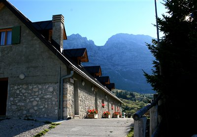
This pasture is very rich both in terms of wildlife and from a naturalistic point of view, thanks to the presence of nettle, ferns, yarrow and mountain sage. The renovation of the buildings involved the historical recovery of the old shelter as a testimony of ancient life in the pastures.
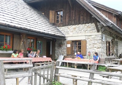
Really switch off, take a deep breath, live in the moment - Straniger Alm pasture, nestled against a breathtaking natural backdrop near the border to Italy, is the perfect place to do just that. The pasture may be reached via a well-maintained gravel path. For long-distance hikers, the pasture on the southern mountain ridge of the Gailtal valley is a great place to rest and one of the most important overnight stops on the Karnischer Höhenweg trail and the Via Alpina between Plöcken Pass and Nassfeld Pass. For mountain bikers, Italy is just a short ride away. Hikers may continue on the cheese-themed circular trail, visit nearby Kordin Alm pasture, or make their way up Waidegger Höhe, Schulterkofel or Hochwipfel mountain. To top up your supplies or purchase some goodies to take home with you, pay the small farm shop a visit. The pasture is farmed by a community from the surrounding villages. Traditional dairy skills are still cultivated on Straniger Alm: Gailtaler Almkäse is made, matured and stored here based on an original recipe. The cheese that owes its savoury note to a small amount of goat's milk is left to ripen in a natural rind. The ancient knowledge of cheese-making is passed on here through workshops and courses. Tours of the pasture, including tastings of its various products, are also organised on a regular basis. Visitors can expect lovingly and creatively prepared dishes, using produce straight from the farm. The pasture and its hut are known for their convivial, relaxed air. Guests quickly turn into friends who return time and time again!
HOW TO GET THERE: take the road from Sella Nevea that leads to the Montasio Plateau. At the end of the road (1502 m), follow the CAI 622 trail and in approximately half an hour, you will reach the mountain hut.